- I'm going to use Dun Beag broch near Struan for this exercise.
- Locate something in the area you are interested in, either by browsing the Skye Archaeology map or searching for the location in Canmore

- If you use one of the Skye maps I've created, you can click on the icon for the site you've chosen and there should be text already copied from Canmore. At the bottom is a link to the actual site on their website.
- If you either click the link, or copy & paste it to a new window/tab, you will see the full description and map.
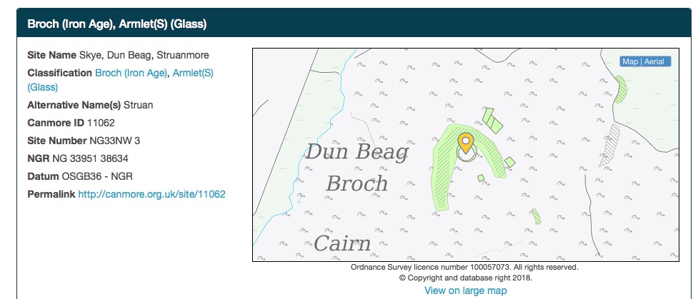
- The Site Number for Dun Beag starts NG33NW - either copy this, or make a note of it.
- Choose Search Sites from the top
- left of the Canmore page menu ...


- ... then paste or type the start of the Site Number in the Mapsheet box and click the Search Sites box in the bottom right corner ...

... and you will get a list of 42 sites in that map-square.
Now comes the magic bit!

At the bottom of the list are buttons to download the details. Click on KML.

- Next, open a new map on Google Maps (maybe I need to write another section on how to do that?) and click on Import
- NO prizes for guessing that you then locate and either click the file you downloaded from Canmore (it will have a weird name like "Canmore-download-Tue, 23 Jan 2018 21_30_31 +0000.kml") OR drag-and-drop it into the box
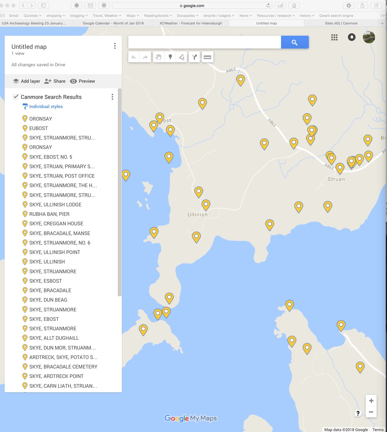
- BINGO!!! You have a new map!
At this point, you realise that I have already imported the text for most of the sites, and there's no point in duplicating that effort, so actually it would be better to start with a copy of the Skye Archaeology map and import onto that, then look for anything new.
No comments:
Post a Comment