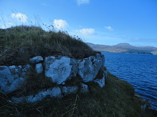
Harlosh Peninsula
Visited on 6.4.2017
The peninsula is accessed from a small quarry, for parking, at
the end of the road from the A863, sign-posted ‘Harlosh’. The whole area is
easy walking with some boggy areas.
Cnoc A’ Cladh –
Chapel and Burial Ground
NG 2835 4082
Follow the path leading south from the quarry, go through a
gate and immediately on your right walk up the small hill and you are in the
site of a chapel and a burial ground. The remains area easily seen – two rectangular
foundations of buildings are easy to pick out. The smaller one is the remains of
a chapel; the larger remains are the walls surrounding the burial ground.
Circling the whole top of the hill are indistinct remains of what appear to
have been a enclosure wall. The site was last surveyed in 2007 but is, as yet,
undated.
Dun Neill – Early Iron
Age Fort
NG 2814 4075
Continue west from the above site towards Loch Vatten and
you will soon see a small inlet in which a steep-sided rocky peninsula can be
seen. This is the site of the dun. Canmore describes it as ‘a dun overlying the
scant remains of a fort on a cliff girt coastal rock’. The cliffs are steep and
encompass the rock. There is only access on the seaward side. Follow the base
of the rock to the right and after turning a slight corner steps can clearly be
seen. I did not go up these but the rest of the group did. There is a lot to be
seen and the archaeology notes on Canmore offer a good resume.
Possible enclosure – unrecorded,
undated
NG 2818 4062
Leaving the dun and heading south up onto the hill, rather
than along the coast, halfway up the hill you will come to a boggy plateau with
the remains of what appear to be a large sub-circular or semi-circular enclosure,
with a low mound in the centre. This appears on OS maps as a semi-circular
enclosure and can be clearly seen on aerial photographs accessible on Canmore
(see https://canmore.org.uk/site/search/result?NUMLINK=10861&view=map
). It is not recorded on Canmore.
Township
NG 2809 4036
Carry on south, along the west side of the loch and you will
arrive at a ruined village, the remains of four houses and two enclosures. One
of the house remains is much bigger than the others. Why? At one end of two of the house is a circle of stones indicating a round partition within the
houses. Were they corn stores? The township is shown on the OS 1st Edition 6-inch map (1843-1882).Link to old map on NLS
 |
| Probably early to mid 20th century sheep dip |


No comments:
Post a Comment