Sites of archaeological interest on Isle of Skye, and nearby places, visited by Isle of Skye U3A
Search This Blog
Saturday, 4 March 2017
Markings on the ground
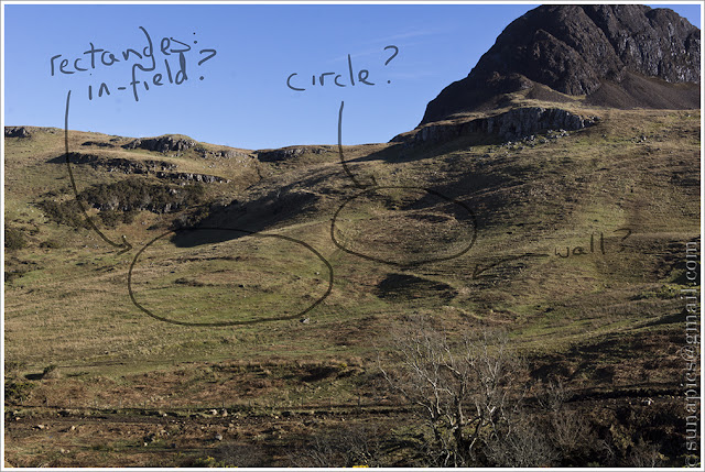
Our recent walk to Dun Sleadale gave us rather a good view across Sleadale Burn to the lumps and bumps of what was (probably) once Talisker village. I'd taken a rather unhelpful printout from the aerial version of Google Maps with the various nearby records from Canmore marked on it, but these were nowhere near ... and once you start to look, the place is covered in lines and outcrops and who-knows-what.
At the time, I assumed that the reason I couldn't spot anything I'd drawn on my plan, but could see lots of other things, was because I'd messed up the locations. Importing data (e.g. from Canmore) and building layers on a Google map is reasonably easy - the map above shows all the archaeological sites on Skye that are recorded by RACMS ... but it's also very easy to shift a whole layer sideways with a twitch of a mouse's whisker.
So, when I got back, I rechecked ... and no, I hadn't got it wrong. I hadn't been able to spot what I was supposed to be able to see, and I saw lots of other things instead.
This one - a line running more or less dead straight south-eastwards (ish), and aligned close to the east side of the broch, reminded me that I'd seen a comment somewhere on this blog about brochs being located at the junction of various lines. Spot the lines, and where they meet ... there will be a broch ... and if it's not on the map, then maybe it's just not been discovered yet.
So - I went back to google maps and their aerial view. Wow, the area is just covered in lines and squiggles and signs of occupation ... and the more you see, the more you can convince yourself are significant and not just accidental exposed seams or gullies in the rock.
Sadly, just when I thought I might be on the track of a Really Important Discovery, Steve T - who has recently spent a lot of time studying territories and boundaries between communities - ruined it all by pointing out the obvious: that boundaries (in the days before cheap 'n' cheerful wire fences) would have run between obvious and immovable landmarks, and thus not need to be marked at all on open ground. You don't get much more obvious or immovable than a broch - with the added bonus that, in a dispute, nobody could say 'Oh, that broch ... no, I'm sure we agreed this one - hard lines, it's my land and I'm not giving it back'.
It was a really interesting exercise, though, and one I'll repeat before we go on our next walk - then, maybe, we can work out whether what is obvious to an eye in the sky is borne out by boots in the bog.
Subscribe to:
Post Comments (Atom)


Studying the remains of post-mediaeval farms may give us ideas about what was happening in earlier times; but even if it doesn't, it would be interesting for its own sake.
ReplyDeleteI agree - one thing that surprised me (though on reflection it shouldn't have) was how little boundaries changed over centuries - even when fields were made bigger, a line of trees might remain (though not on tree-less Skye!!!). Holdings were merged or divided but still kept their shape. So yes, later occupations could well help us. Good idea!
ReplyDelete